
Features Ignis Pixhawk
Enhance your missions with Pixhawk drones.
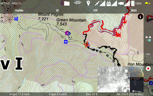
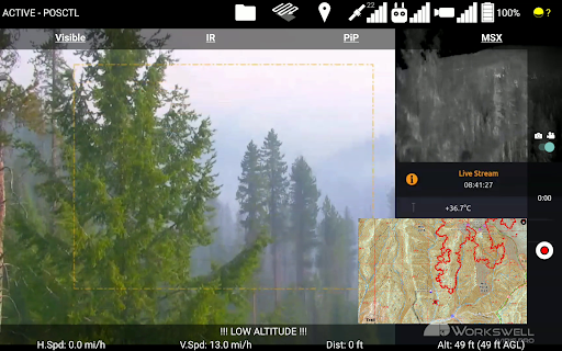
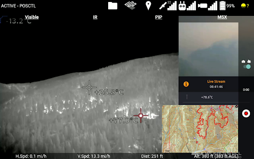
Features:- Offline satellite and elevation maps- Terrain-aware waypoint missions- Mapping mission planning and execution- Import PDF and KMZ map overlays- Connect to your drones radio via the internet, USB, or Bluetooth- Live video feed via the RTSP internet protocol- Control Gremsys Pixy U gimbal, and Workswells Wiris Pro EO/IR camera- Control Drone Amplifieds Ignis payload to conduct prescribed burns- Mark locations of interest and features and save them as a KMZ file- View nearby aircraft via ADSB- Supports Px4 and Arducopter flight controller firmwares
Social Features
Connect and share with friends and the community.
Camera Features
Advanced camera features with editing capabilities.
Travel Features
Plan and manage your travels with ease.
See the Ignis Pixhawk in Action
Get the App Today
Available for Android 8.0 and above